|
||||||||||||
|
|
|
Greenland
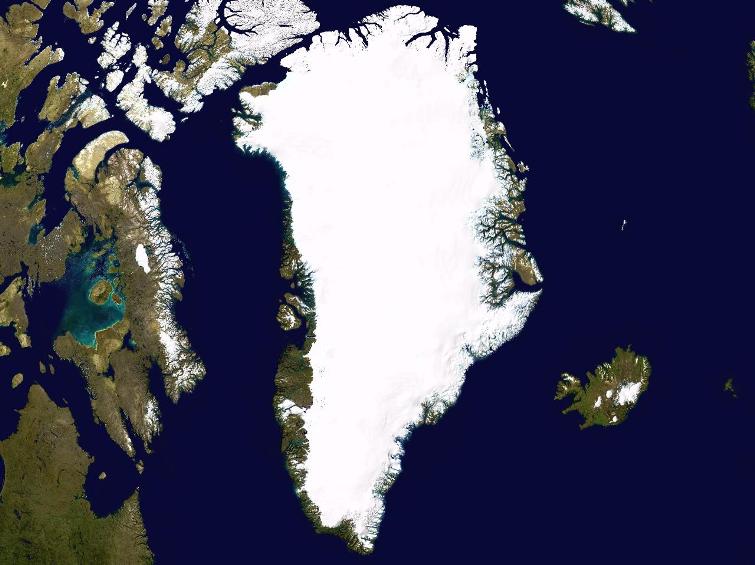
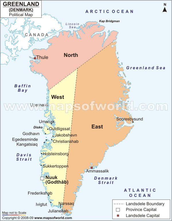
Greenland, the world's largest island, is about 80% ice capped. Vikings reached the island in the 10th century from Iceland; Danish colonization began in the 18th century, and Greenland was made an integral part of Denmark in 1953. It joined the European Community (now the EU) with Denmark in 1973 but withdrew in 1985 over a dispute centered on stringent fishing quotas. Greenland was granted self-government in 1979 by the Danish parliament; the law went into effect the following year. Greenland voted in favor of increased self-rule in November 2008 and acquired greater responsibility for internal affairs in June 2009. Denmark, however, continues to exercise control of Greenland's foreign affairs, security, and financial policy in consultation with Greenland's Home Rule Government.
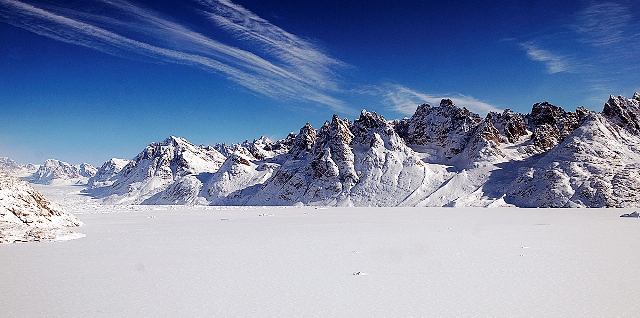
The climate in Greenland is extremely harsh. More than 80% of the island is covered by an ice cap which is 4km thick in places. Many of the Eskimo (Inuit) people survive by hunting and fishing and are struggling as fish stocks become depleted. The island's population is only 57,000. The capital of Greenland is Nuuk. It is also the largest city of Greenland. University of Greenland is located at the capital city and Air Greenland offers regular flight service to Nuuk Airport.
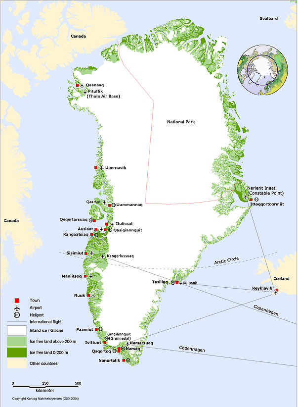
Cities in Greenland
fall under different regions which are divided on the basis of
population
of that area. The cities vary in their importance and features.
1. The central region--Nuuk and Sisimiut Most densely populated, and comprising the municipalities of Paamiut, Nuuk, Maniitsoq, Kangaatsiaq and Sisimiut, this region forms the financial hub of the country.
Made up of the municipalities of Aasiaat, Qasigiannguit, Qeqertarsuaq and Ilulissat this region consists of a quarter of Greenland's population.
Commercially underdeveloped, this area has the municipalities of Uummannaq, Upernavik, Qaanaaq, Ammassalik and Ittoqqortoormiit. 20% of Greenland populations who live in this area depend on marine mammals and fishing. 4. The Southern Region Municipalities of Nanortalik, Qaqortoq and Narsaq lie in this region. Agriculture, fishing, sheep farming and gold mining form the major occupational activities of this region.
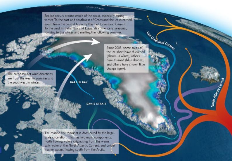
Credit: http://www.mapsofworld.com Recent environmental studies have raised fears that global warming is causing Greenland's ice cover to melt increasingly fast and that this could have serious implications for future sea levels and ocean currents unless the process is rapidly halted and then reversed.
The response of the Greenland Ice Sheet to a changing climate is complex. It depends on the interactions between the ice sheet, the atmosphere, and the ocean. Only recently have complex mathematical models been developed that describe this system as a whole and this has improved our ability to model the natural system as a whole.
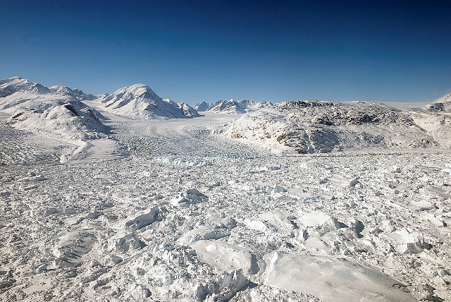
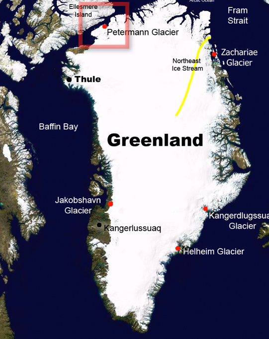
Kangerdluqssuaq Glacier (credits: M. Studinger NASA) Improving estimates of the balance at the ice sheet surface, now and in the future, relies on being able to downscale regional atmospheric models and to understand the processes controlling the fast-fl owing ice streams. Additional uncertainties concern our understanding of the influence of melt water below significant parts of the Greenland Ice Sheet. It is important to remember that all models rely on assumptions and that as a result all model projections come with a level of uncertainty. Uncertainties tend to increase the further the projections extend into the future. However, as long as the uncertainties are properly understood, models provide perhaps the only tool currently available for predicting what the future will bring.
Kangerdluqssuaq Glacier (credits: M. Studinger NASA) Despite their limitations, it is clear from the mathematical models that the Greenland Ice Sheet is very sensitive to climate warming.
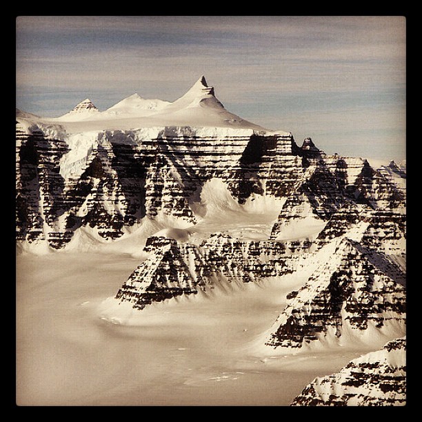
Mountain ridges showing the distinctive geology of the Geikie Plateau region in eastern Greenland, as seen from NASA's P-3B aircraft on April 16, 2012. This image was captured during NASA’s IceBridge campaign. IceBridge, a six-year NASA mission, is the largest airborne survey of Earth's polar ice ever flown. It will yield an unprecedented three-dimensional view of Arctic and Antarctic ice sheets, ice shelves and sea ice. These flights will provide a yearly, multi-instrument look at the behavior of the rapidly changing features of the Greenland and Antarctic ice. Credit: NASA/GSFC/Jefferson Beck The Greenland Ice Sheet is losing mass in response to recent climate warming. Even if temperatures stabilize, the ice sheet will continue to melt for some time. Beyond a certain point the ice sheet may even enter a state of ‘irreversible destabilization’ leading to a complete melting of the ice sheet – as happened to the ice sheets that covered much of northern Europe and North America at the end of the last ice age. Under this scenario, Greenland would lose its ice sheet until such time as a new glaciation occurred. The surface warming at which the melting of the ice sheet would become ‘irreversible’ is a so-called ‘threshold’.
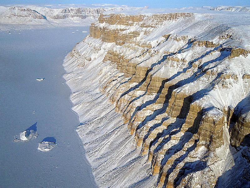
Northwest Greenland Canyons-On March 29, 2011, Operation IceBridge flew
between deep canyons and over glaciers along the northwest coast of
Greenland. IceBridge, now in its third year, makes annual campaigns in the
Arctic and Antarctic where science flights monitor glaciers, ice sheets
and sea ice.
|