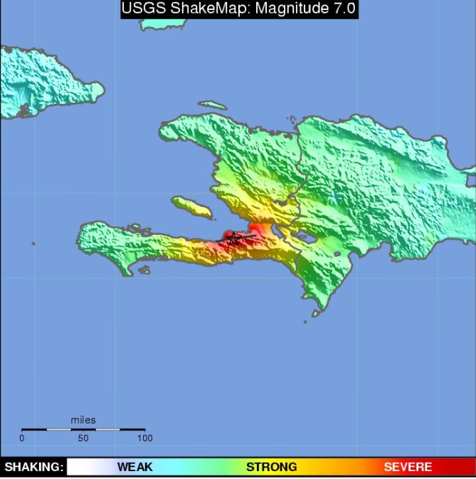
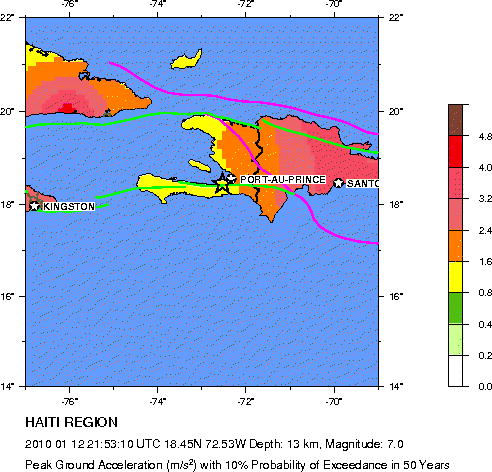
Severe damage and casualties in
the Port-au-Prince area. Felt throughout Haiti and the Dominican Republic, in
Turks and Caicos Islands, southeastern Cuba, eastern Jamaica, in parts of Puerto
Rico and the Bahamas, and as far as Tampa, Florida and Caracas, Venezuela.
Major Tectonic Boundaries: Subduction Zones -purple,
Ridges -red and Transform Faults -green
Tectonic Summary
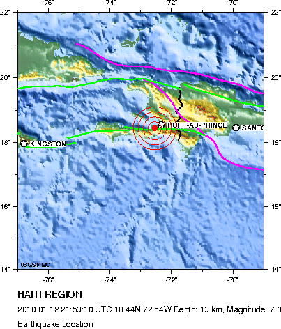
The January 12, 2010, Haiti
earthquake occurred in the boundary region separating the Caribbean plate and
the North America plate. This plate boundary is dominated by left-lateral strike
slip motion and compression, and accommodates about 20 mm/y slip, with the
Caribbean plate moving eastward with respect to the North America plate.
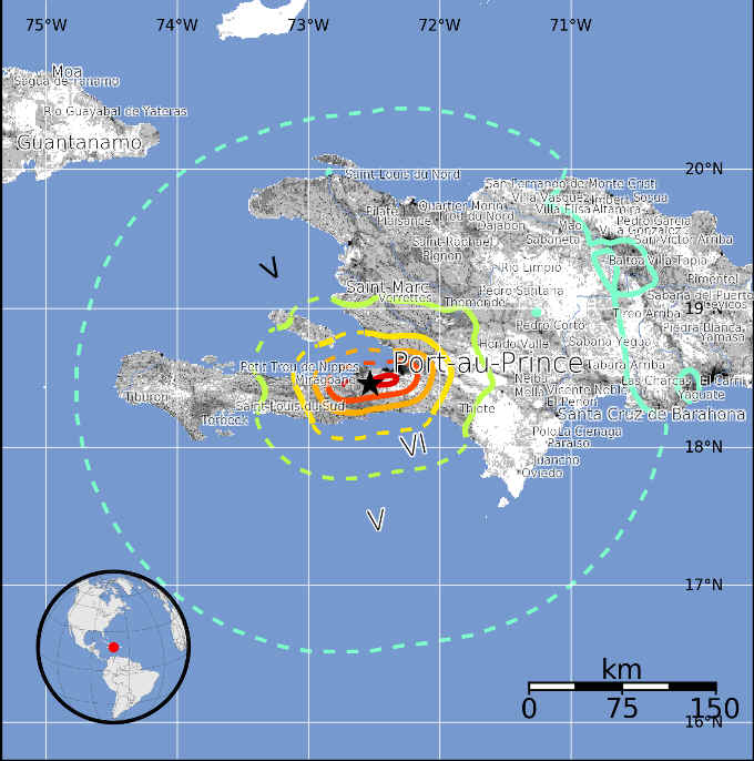
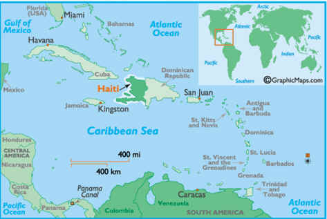
Haiti occupies the western part
of the island of Hispaniola, one of the Greater Antilles islands, situated
between Puerto Rico and Cuba. At the longitude of the January 12 earthquake,
motion between the Caribbean and North American plates is partitioned between
two major east-west trending, strike-slip fault systems -- the Septentrional
fault system in northern Haiti and the Enriquillo-Plantain Garden fault system
in southern Haiti.
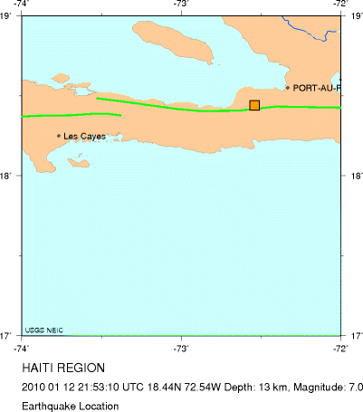
The location and focal mechanism
of the earthquake are consistent with the event having occurred as left-lateral
strike slip faulting on the Enriquillo-Plantain Garden fault system. This fault
system accommodates about 7 mm/y, nearly half the overall motion between the
Caribbean plate and North America plate.
The Enriquillo-Plantain Garden
fault system has not produced a major earthquake in recent decades. The EPGFZ is
the likely source of historical large earthquakes in 1860, 1770, and 1751,
though none of these has been confirmed in the field as associated with this
fault.
Sequence of events possibly
associated with the Enriquillio fault in 1751-1860 are as follows.
October 18, 1751: a major
earthquake caused heavy destruction in the gulf of Azua (the eastern end of the
Enriquillio Fault) which also generated a tsunami. It is unclear if the rupture
occurred on the Muertos thrust belt or on the eastern end of Enriquillio Fault.
Nov. 21, 1751: a major earthquake
destroyed Port Au Prince but was centered to the east of the city along the Cul
de-Sac plain.
June 3, 1770: a major earthquake
destroyed Port Au Prince again and appeared to be centered west of the city. As
a result of the 1751 and 1770 earthquakes and minor ones in between, the
authorities required building with wood and forbade building with masonry.
April 8, 1860: there was a major
earthquake farther west accompanied by a tsunami