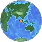
Magnitude
9.0 OFF THE WEST COAST OF NORTHERN SUMATRA
Sunday, December 26, 2004 at 00:58:53 UTC
Preliminary Earthquake Report
U.S. Geological Survey, National Earthquake Information Center
World Data Center for Seismology, Denver
The devastating megathrust
earthquake of December 26, 2004, occurred on the interface of the India and
Burma plates and was caused by the release of stresses that develop as the India
plate subducts beneath the overriding Burma plate. The India plate begins its
descent into the mantle at the Sunda trench, which lies to the west of the
earthquake's epicenter. The trench is the surface expression of the plate
interface between the Australia and India plates, situated to the southwest of
the trench, and the Burma and Sunda plates, situated to the northeast.
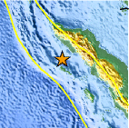
In the region of the earthquake,
the India plate moves toward the northeast at a rate of about 6 cm/year relative
to the Burma plate. This results in oblique convergence at the Sunda trench. The
oblique motion is partitioned into thrust-faulting, which occurs on the
plate-interface and which involves slip directed perpendicular to the trench,
and strike-slip faulting, which occurs several hundred kilometers to the east of
the trench and involves slip directed parallel to the trench. The December 26
earthquake occurred as the result of thrust-faulting.
Preliminary locations of larger
aftershocks following the megathrust earthquake show that approximately 1200 km
of the plate boundary slipped as a result of the earthquake. By comparison with
other large megathrust earthquakes, the width of the causative fault-rupture was
likely over one-hundred km. From the size of the earthquake, it is likely that
the average displacement on the fault plane was about fifteen meters. The sea
floor overlying the thrust fault would have been uplifted by several meters as a
result of the earthquake. The above estimates of fault-dimensions and
displacement will be refined in the near future as the result of detailed
analyses of the earthquake waves.
The world's largest recorded
earthquakes have all been megathrust events, occurring where one tectonic plate
subducts beneath another. These include:
the magnitude 9.5 1960 Chile
earthquake, the magnitude 9.2 1964 Prince William Sound, Alaska, earthquake, the
magnitude 9.1 1957 Andreanof Islands, Alaska, earthquake, and the magnitude 9.0
1952 Kamchatka earthquake. As with the recent event, megathrust earthquakes
often generate large tsunamis that cause damage over a much wider area than is
directly affected by ground shaking near the earthquake's rupture
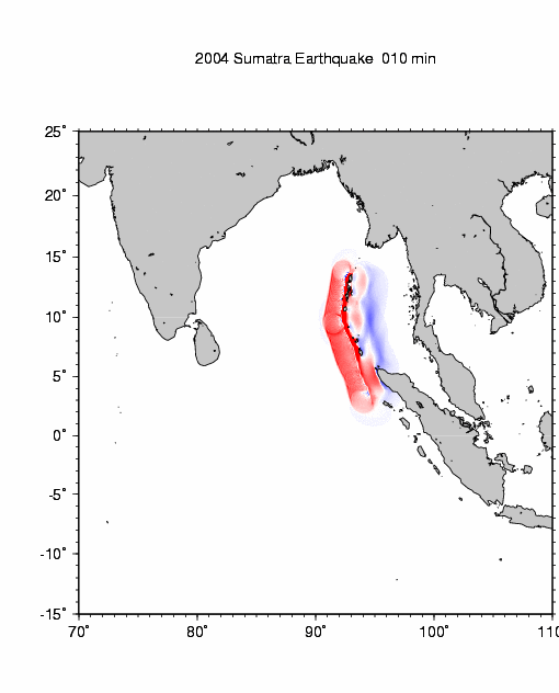
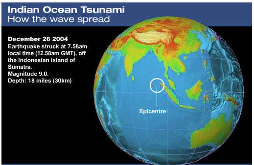
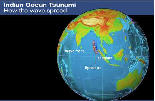
The great earthquake (Mw 9.0) of December 26 off Sumatra generated the tsunami in the Indian Ocean.According to U.S.G.S., the aftershocks extended as far as 1,000 km toward
north (the red circles indicate aftershocks occurred within 24 hours).Assuming that the aftershock area represents the tsunami source, the
tsunami propagation was computed.
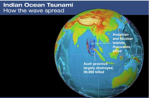
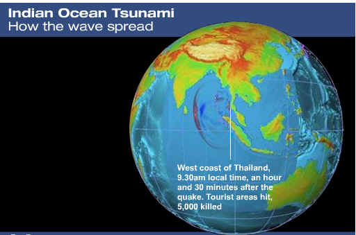
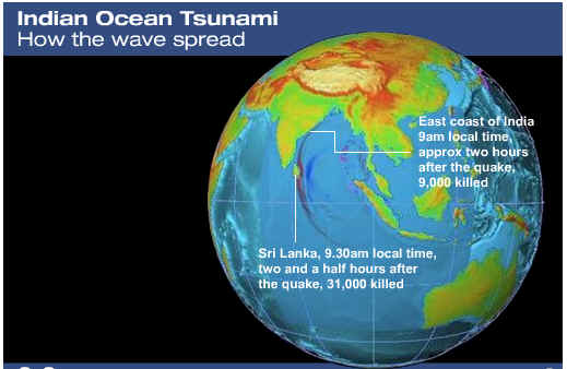
The tsunami propagation is also animated (up to 5 hours) from a 1200 km fault.
The red color means that the water surface is higher than normal, while the blue
means lower. It indicates that initial tsunami to the east (e.g.,
Phuket) began with receding wave, while to the west (e.g., Sri Lanka
) large wave suddenly reached. The darker the color, the
larger the amplitude.The
tsunamis were larger in the east and west directions.
Tsunami Animation: Courtesy: National Institute
of Advanced Industrial Science and Technology, Japan